Land preparation

What are the implications of changing land use and deforestation for agriculture?

deforestation

Loss of Agricultural Land: Deforestation frequently entails the clearance of trees for other land uses like agriculture, infrastructure construction, or urbanization. As a result, valuable agricultural land is lost, lowering the amount of land that may be used to grow food. Farmers may thus encounter difficulties when they try to increase agricultural production and satisfy the rising food demand.

Environmental Impact: Deforestation causes biodiversity loss and environmental degradation. In order to preserve ecosystem equilibrium, provide home for wildlife, and support fundamental ecological processes, forests are necessary. Loss of important ecosystem services, soil erosion, water pollution, and reduced water availability can all result from the clearing of forests for agricultural purposes. Agriculture’s productivity and sustainability may be significantly impacted by this.

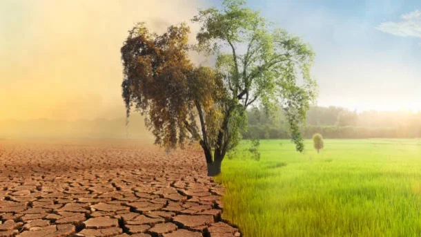
Land use changes and deforestation both contribute to climate change. By removing and storing carbon dioxide from the atmosphere, forests serve as carbon sinks. When forests are cut down, the carbon that has been stored there is released, which increases greenhouse gas emissions. Deforestation also disturbs regional and local climate patterns, influencing temperature regulation, rainfall patterns, and general climatic conditions that are essential for agricultural output.

Biodiversity loss is a result of deforestation, which causes many different plant and animal species to lose their habitats. Compared to natural ecosystems, agricultural landscapes often have reduced biodiversity. The loss of biodiversity can alter the ecological balance, have an impact on pollination, insect management, nutrient cycling, and make agriculture more susceptible to pests and illnesses.

What are the current discussions on the impact of agriculture on climate change?

agriculture

Greenhouse Gas Emissions: Agriculture is a major source of greenhouse gas (GHG) emissions, particularly through the production of nitrous oxide (from fertilizers and manure management) and methane (from cattle and rice agriculture). Strategies to lower these emissions are discussed, including better fertilizer management, the adoption of low-emission livestock systems, and the promotion of more environmentally friendly rice growing methods.

A considerable amount of carbon dioxide is released into the atmosphere as a result of deforestation and land use change caused by agriculture, particularly the expansion of agricultural land. The discussions center on stopping deforestation, safeguarding forests and other natural ecosystems, and encouraging climate change mitigation strategies including agroforestry and replanting.

Discussions have focused on how agriculture has the ability to store carbon in soils, which can reduce greenhouse gas emissions. Improved soil health can aid in carbon sequestration and increase agricultural sustainability through techniques including cover crops, conservation tillage, and organic matter additions.

Adaptation and Resilience: Agricultural systems face difficulties as a result of climate change effects such as altered precipitation patterns, an increase in the frequency of extreme weather events, and temperature swings. The adoption of climate-resilient crop varieties, water management techniques, and system diversification are just a few examples of how resilience and adaptive ability are being built into agricultural practices and systems.

What are the efforts to promote sustainable land use and ecosystem conservation?

ecosystem

International Accords and Conventions: International pacts like the UN Convention on Biological Diversity (CBD) and the UN Framework Convention on Climate Change (UNFCCC) are essential for advancing ecological preservation and sustainable land use. For governments to protect and restore ecosystem, preserve biodiversity, and lower greenhouse gas emissions from land-use changes, these accords set goals and frameworks.

Protected Areas and National Parks: It is commonly accepted that the best way to preserve ecosystem and biodiversity is to create and extend protected areas and national parks. These places protect vital habitats, provide refuge for extinct species, and aid in scientific and educational endeavors. To construct and manage protected areas, governments, nongovernmental organizations, and international organizations collaborate.

Balance between the economic, social, and ecological elements of using forests is the goal of sustainable forest management techniques. This entails obtaining both timber and non-timber forest products while promoting reforestation, halting deforestation, and safeguarding biodiversity. Responsible forest management is encouraged by certification schemes like the Forest Stewardship Council (FSC).

Reforestation vs afforestation: Reforestation is the practice of replanting trees in previously deforested areas, whilst afforestation is the practice of planting trees in places that have never been covered by forests. These programs aid in stopping deforestation, boosting carbon sequestration, and restoring ecosystems.

How are farmers using satellite imagery and GIS for land management and monitoring?

imagery

Farmers are using Geographic Information System (GIS) technology and satellite imagery more and more for land management and monitoring. Here are some significant applications of these technologies:

Crop monitoring and yield estimation are made possible by satellite imagery, which gives farmers a bird’s-eye perspective of their fields and enables them to track crop development, identify stress factors, and calculate yields. Farmers can spot changes in crop health, nutritional deficits, pest infestations, and disease outbreaks by examining satellite photos. They can use this knowledge to make educated decisions about irrigation, fertilizer use, and pest control, which results in more effective resource management and higher crop output.

GIS and satellite imagery are essential components of precision agriculture techniques. Farmers can improve yields by combining information from satellite pictures, soil sensors, and other sources.

Crop Rotation and Land Use Planning: GIS and satellite imagery help with crop rotation and land use planning techniques. Farmers can evaluate the viability of various regions of their property for particular crops based on criteria like soil type, terrain, and drainage by analyzing historical and current satellite pictures. In order to reduce disease pressure, nitrogen depletion, and soil erosion while increasing yields and maintaining soil health, farmers can use GIS technologies to construct the best crop rotation schedules.

Irrigation management: GIS and satellite-based data are useful resources for enhancing irrigation procedures. Farmers may determine the amount of water crops will need and keep track of the soil moisture levels in their fields by combining satellite photography, weather information, and evapotranspiration models. This knowledge enables them to more accurately plan irrigation, preventing under- or over-irrigation, minimizing water waste.

What are the implications of urbanization on agricultural land use and productivity?

urbanization

Urbanization has several implications for agricultural land use and productivity. Here are some key implications:

Land Conversion: Urbanization often leads to the conversion of agricultural land into residential, commercial, or industrial areas. As cities expand and population density increases, agricultural land is gradually transformed into urban infrastructure, including buildings, roads, and other urban amenities. This conversion reduces the total area of available agricultural land, leading to a decline in agricultural production capacity.

Fragmentation and Loss of Agricultural Land: Urbanization can result in the fragmentation of agricultural land into smaller parcels due to land subdivision and development. Fragmentation makes it challenging for farmers to maintain viable agricultural operations and implement efficient land management practices. Moreover, the encroachment of urban areas can lead to the complete loss of agricultural land, further reducing the overall agricultural productivity of the region.

Urbanization frequently generates demand for surrounding agricultural land to supply food and other agricultural products to the expanding urban population. This puts pressure on productive agricultural land. As a result, there might be more pressure to convert fertile agricultural land that is adjacent to cities. This may result in the loss of irrigated, fertile land, which could have an impact on potential agricultural output and food production.

Farming practices might change as a result of urbanization as conventional agricultural systems are modified or replaced to meet the needs and restrictions of the city. For instance, high-value crops or horticulture may become the focus of commercial farming as these industries might be more lucrative in urban markets. Additionally, to make use of the limited urban space, urban agriculture techniques like rooftop gardens, vertical farming, or community gardens may emerge.

 How are smart sensors used for monitoring soil conditions?

smart sensors

In order to regulate irrigation effectively, it is essential to measure the moisture content of the soil using soil moisture smart sensors. To track moisture levels at multiple layers, these sensors can be inserted at various depths in the soil profile. Farmers may optimise irrigation practises, prevent under- or overwatering, and determine when and how much water to use by continuously monitoring soil moisture. Farmers can monitor soil moisture levels and make irrigation decisions based on reliable information thanks to the real-time data that smart soil moisture smart sensors provide.

Sensors that monitor soil temperature can gauge the temperature of the ground at different depths. Seed germination, nutrient availability, microbial activity, and plant growth are all influenced by soil temperature. Farmers can choose the ideal soil temperature by keeping an eye on it.

pH sensors for soil: These sensors gauge the soil’s acidity or alkalinity. The availability of nutrients to plants is impacted by soil pH, which also impacts soil microbial activity. Farmers can assess the compatibility of the soil for various crops by monitoring the pH of the soil and can determine whether pH adjustments through soil amendments are necessary. The accurate and fast pH measurements provided by smart soil pH sensors enable farmers to maintain the ideal pH values for certain crops and modify their soil management techniques as necessary.

The amounts of different nutrients in the soil, such as nitrogen, phosphorous, and potassium, which are critical for plant growth, are measured using soil nutrient sensors. Farmers can optimise fertiliser applications and avoid nutrient excesses or shortfalls by keeping track of the soil’s nutrient levels. Real-time nutrient data is provided by intelligent soil nutrient sensors.

How are weather prediction models used in agriculture?

prediction models

Weather prediction models offer information about expected weather patterns, including temperature, precipitation, wind speed, and humidity. This knowledge can be used by farmers to plan and modify planting dates, choose the right crop kinds, and control irrigation and fertilization practices. Farmers can maximize crop growth and reduce hazards by planning activities around anticipated weather conditions.

Irrigation management: By predicting rainfall and calculating crop water needs, weather prediction models assist farmers in optimizing their irrigation practises. Farmers can select the best times and amount to irrigate their fields by considering forecasted precipitation and evapotranspiration rates. By doing this, it is possible to avoid under- or over-irrigation, conserve water, and guarantee that crops receive the right amount of moisture for healthy growth.

Management of Pests and Diseases: Weather has a big impact on population dynamics. Several learning models such as ensemble learning , machine learning and deep learning  were utilized for the prediction of weather conditions and soil nutrient analysis suitable for crops

How is blockchain technology being implemented in the agricultural supply chain?

agricultural supply chain

Product tracability: Thanks to blockchain technology, every agricultural product transaction and movement along the agricultural supply chain may be recorded and tracked. The blockchain can be used to track every stage, including production, processing, packing, shipping, and distribution. Consumers and stakeholders may confirm the product’s origin, quality, and authenticity thanks to this immutable and transparent record of its journey.

Transparency in the agricultural supply chain is made possible by blockchain technology, which gives farmers, processors, distributors, retailers, and consumers access to a shared, decentralised ledger. By making transactions transparent, fraud, forgery, and unethical behaviour are reduced. The supply chain’s integrity and dependability are ensured by participants’ capacity to validate and verify the data stored on the blockchain.

Quality and Standards Assurance: Blockchain can be used to store and exchange data on the certifications of products as well as their adherence to standards and laws. This information may cover specifics regarding farming techniques, the use of pesticides and fertilisers, organic certifications, fair trade principles, and other topics. Consumers can make educated decisions and feel confident about the things they buy by having access to this information via the blockchain.

Efficient Payment and Transactions: Blockchain technology makes it possible for the agricultural supply chain to conduct safe and effective digital transactions. Processes like payments, invoicing, and settlements can be automated and streamlined using smart contracts, which are self-executing contracts on the blockchain. This leads to quicker and more secure transactions by reducing paperwork, lowering transaction costs, and doing away with the need for middlemen.

How land is prepared for Broccoli Farming?

Broccoli

Land preparation for Broccoli farming :

  • Soil preparation: The soil should be well-drained, rich in organic matter and with a pH of 6.0 to 7.0. To prepare the soil, it should be cleared of all weeds, rocks and debris, and plowed or rototilled to a depth of about 8 to 10 inches.
  • Fertilizer application: Add compost or well-rotted manure to the soil before planting. A balanced fertilizer mix, such as 10-10-10, can be added to the soil, but be sure to follow the recommended application rates on the label.
  • Irrigation setup: Irrigation systems, like sprinklers or drip irrigation, should be installed, especially in low rainfall areas for broccoli cultivation.
  • Soil test: It is important to get a soil test before planting to determine the nutrient levels in the soil and any necessary adjustments that need to be made.
  • Rows and spacing: Rows should be spaced about 3 feet apart with plants spaced about 18 to 24 inches apart within the row. This will allow enough space for the plants to grow and develop properly.
  • Mulching: A layer of mulch should be applied to the soil between the rows to conserve moisture, suppress weeds and regulate soil temperature.
  • Proper weeding: Weeds should be kept under control by removing them by hand or using a hoe. Regular weeding is important to prevent competition for light, water and nutrients.

How to prepare soil for cucumber farming?

cucumber

Preparing the soil for cucumber farming involves several steps:

  1. Soil testing: Conducting a soil test can help determine the pH level and nutrient content of the soil, which will inform what soil amendments may be necessary. Cucumbers prefer a slightly acidic soil with pH between 5.5 and 6.8.
  2. Soil amendment: Add organic matter such as compost or well-rotted manure to the soil to improve its structure and fertility. This will also help to improve water retention and drainage.
  3. Fertilization: Based on the soil test results, add the necessary nutrients and fertilizers to the soil. Cucumbers are heavy feeders, they require a lot of nitrogen and potassium.
  4. Drainage: Make sure the soil is well-drained and that there is no standing water in the field. Cucumbers are sensitive to waterlogging and can be easily damaged by excess water.
  5. Irrigation: Irrigation is important in cucumber farming. Cucumber plants need to be kept consistently moist, but not waterlogged. Drip irrigation is the best method for cucumber farming.
  6. Bed formation: Form raised beds of around 1-2 feet high and 3-4 feet wide. This will help with drainage and make it easier to control the weeds.
  7. Cover cropping: Consider planting a cover crop before planting cucumbers. Cover crops like rye or buckwheat can help to improve soil health and suppress weeds.
  8. Pest and disease management: Before planting, it is important to ensure that the soil is free of pests and disease. Use appropriate pest control methods and fumigate the soil if necessary.

It is important to remember that the specific needs of the soil can vary depending on the location, weather, and other environmental factors.